
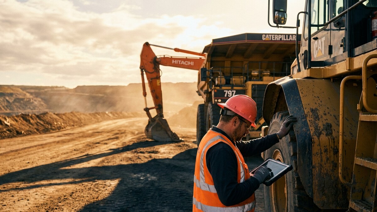
Managing high-value equipment across vast, remote mining sites is a constant operational challenge. Haul trucks, excavators, dozers, and drills each represent a major investment you must protect, use efficiently, and maintain on schedule. Poor visibility drives costly downtime, security risk, and missed production targets. Tracking technology has become a core driver of mine profitability. Mines that adopt automation and heavy equipment monitoring report up to a 30% gain in equipment productivity by cutting manual work and human error.
The right GPS system does more than plot dots on a map. It reports engine hours, fuel burn, operator behavior, and maintenance needs. That insight drives predictive maintenance, protects asset utilization, and safeguards your return on investment. Match your site’s real constraints, from weak signal in underground shafts to rugged hardware on the surface, with a platform that delivers reliable intelligence.
| Platform | Network | Best For | Starting Price | Key Strength |
|---|---|---|---|---|
| GPX | Cellular, Satellite, BLE | Predictive analytics and multi-sensor visibility | As low as $45/yr per tag (AssetTag Pro) | AI-powered operational intelligence |
| Geotab | Cellular, Satellite | Comprehensive fleet management and safety | – | Extensive third-party integration market |
| Trimble | GPS, LIDAR, Satellite | complete mine data integration | – | Full-site surveying and machine guidance |
| Hexagon Mining | GPS, Cellular, Wi-Fi | Life-of-mine safety and autonomy | – | Collision avoidance and autonomous tech |
| Komatsu (Modular Mining) | GPS, Wi-Fi | Large-scale haulage optimization | – | Deep integration with Komatsu equipment |
| MapTrack | GPS, QR Code | Mixed asset and compliance management | – | Strong offline and underground capability |
| Track Star | Cellular, Satellite, OEM | Diverse asset visibility | – | Centralized tracking for mixed fleets |
| Geoforce | Cellular, Satellite | Rugged asset traceability | – | Industrial-grade solar-powered trackers |
| Raveon (RavTrack) | VHF/UHF Radio | Subscription-free open-pit tracking | – | No recurring fee for base system |
1. GPX
GPX runs an AI-powered asset intelligence platform built for the extreme demands of mining. It fuses multi-sensor data from cellular, satellite, and BLE devices into one operational view. The Scout AI engine turns location data into predictive insight, forecasting maintenance needs, optimizing asset allocation, and preventing downtime before it starts. Ruggedized hardware handles the dust, moisture, and vibration of any mine, from a haul truck on the surface to components inside the processing plant.
- Location: USA
- Best for: Operations moving from reactive monitoring to predictive, AI-driven asset management.
- Pricing: Custom quote based on asset count and feature requirements.
- Connectivity: Multi-network coverage including 4G/5G LTE-M, Cat-M1, NB-IoT, satellite, and BLE.
- Standout features: Scout AI for prescriptive intelligence, multi-sensor data fusion, ruggedized hardware for harsh environments, and advanced geofencing for safety and security.
Highlights
- The AI engine sends predictive maintenance alerts and utilization recommendations that cut costs.
- Multi-network connectivity holds a signal in remote and challenging locations.
- One platform tracks every asset, from heavy machinery to smaller equipment.
- Advanced geofencing and unauthorized-use alerts protect the site and deter theft.
- Scalable architecture fits any operation, from a single quarry to a global enterprise.
2. Geotab
Geotab is a global leader in fleet management and monitors both on-road and off-road mining equipment. Its open platform and the Geotab Marketplace let users add third-party apps for safety, compliance, and productivity. For mining, Geotab ships ruggedized GO Anywhere asset trackers rated IP68 and IP69-K for harsh conditions.
- Location: Oakville, Ontario, Canada
- Best for: Comprehensive fleet management, safety, and compliance for mixed fleets.
- Connectivity: Cellular, Satellite
- Standout features: GO Anywhere ruggedized tracker, collision avoidance, an extensive integration marketplace, and strong fuel-consumption reporting.
Highlights
- Highly customizable and scalable platform.
- Vast selection of third-party integrations.
- Strong focus on driver safety and regulatory compliance.
Watch-outs
- Pricing is not public and usually runs through a reseller.
- The volume of data and options can overwhelm smaller operations.
3. Trimble
Trimble bundles surveying, machine guidance, fleet management, and analytics under its Trimble Connected Mine™ platform. It consolidates that data into one interface and gives a full view of the mine, from geological modeling to real-time production. Dedicated tools serve both surface and underground operations.
- Location: Westminster, Colorado, USA
- Best for: Large operations that want a fully integrated, end-to-end site solution.
- Connectivity: GPS, LIDAR, Satellite, Wi-Fi
- Standout features: Connected Mine™ platform, AI-powered slope-stability analysis, machine guidance, and underground surveying tools.
Highlights
- One interface integrates every aspect of mine operations.
- Advanced geospatial data and surveying capabilities.
- Supports both surface and underground mining.
Watch-outs
- Full implementation is a significant financial and operational investment.
- Overly complex for operations that need only basic asset tracking.
4. Hexagon Mining
Hexagon Mining connects planning, operations, and safety across the life of a mine. Its Collision Avoidance System (CAS) leads the industry on site safety. The platform links data from many sources to optimize production, manage fleets, and advance automation. Its ISO/IEC 27001:2022 certification signals a strong commitment to information security, which matters for enterprise operations.
- Location: Tucson, Arizona, USA
- Best for: Mines that prioritize safety, collision avoidance, and autonomous technology.
- Connectivity: GPS, Cellular, Wi-Fi
- Standout features: Industry-leading Collision Avoidance System (CAS), blast-movement intelligence, fleet management, and autonomous vehicle technology.
Highlights
- Solutions cover the entire mining lifecycle.
- Strong reputation for safety and collision avoidance.
- Certified to high information-security standards.
Watch-outs
- Pricing and implementation details are not public.
- Deep integration makes it hard to pair with other vendors’ solutions.
5. Komatsu (Modular Mining)
As an OEM, Komatsu delivers deeply integrated mine-management systems through its Modular Mining subsidiary. The DISPATCH® Fleet Management System is an industry standard for optimizing load-and-haul in large open-pit mines. Intelligent algorithms assign haul trucks to shovels and crushers, cutting queue times and raising productivity. Its Autonomous Haulage System (AHS) ranks among the most mature on the market.
- Location: Tucson, Arizona, USA (Modular Mining HQ)
- Best for: Large mines, especially those running Komatsu equipment, focused on haulage and automation.
- Connectivity: GPS, Wi-Fi
- Standout features: DISPATCH® Fleet Management System, ProVision® machine guidance, Autonomous Haulage System (AHS), and advanced material-blending modules.
Highlights
- Proven in large, complex mining operations.
- Deep integration and optimization for Komatsu equipment.
- Strong focus on productivity, automation, and efficiency.
Watch-outs
- Limited flexibility for mixed fleets from many manufacturers.
- Geared mainly toward large surface-mining operations.
6. MapTrack
MapTrack manages everything from heavy machinery to handheld tools. Its dual-layer system uses GPS for large equipment and QR-code scanning for smaller, portable assets. Offline mobile capture lets crews run inspections and log data in underground sites with no connectivity. The platform leans hard into compliance and maintenance scheduling.
- Location: Adelaide, Australia
- Best for: Tracking a wide range of assets while prioritizing compliance and maintenance in remote or offline settings.
- Connectivity: GPS, QR Code Scanning
- Standout features: Offline mobile data capture, QR-code tracking for tools, daily plant pre-start checklists, and meter-based maintenance scheduling.
Highlights
- Excellent offline capability for underground and remote work.
- Detailed, integrated compliance and maintenance features.
- Scales from heavy equipment down to individual tools.
Watch-outs
- Pricing is not public.
- Support and presence concentrate in the Australian market.
7. Track Star
With 25 years in the field, Track Star centralizes visibility across a diverse mining fleet. It consolidates OEM data feeds, aftermarket cellular devices, and satellite trackers into one interface. Managers watch heavy equipment, support vehicles, attachments, and fixed infrastructure from a single screen, which cuts asset loss and surfaces underused equipment.
- Location: USA
- Best for: A unified view of utilization and location across a wide, diverse asset base.
- Connectivity: Cellular, Satellite, OEM integration
- Standout features: Centralized visibility for all asset types, integration with existing OEM data, movement-history playback, and ruggedized hardware options.
Highlights
- Cuts downtime and underutilization across the whole site.
- Supports a wide array of asset types and data sources.
- Long-standing company with deep industrial-fleet experience.
Watch-outs
- Pricing is not published.
- Fewer public case studies than larger competitors.
8. Geoforce
Geoforce builds rugged, field-ready GPS tracking for industrial assets. Its hardware survives harsh environments, with industrial-grade solar-powered and cellular trackers. Global traceability suits companies running assets across many sites or countries. The software sticks to core tracking: location, status reporting, geofencing, and usage monitoring to control cost and lift productivity.
- Location: Dallas, Texas, USA
- Best for: Surface mines that need durable hardware for asset traceability and cost control.
- Connectivity: Cellular, Satellite
- Standout features: Industrial-grade solar-powered satellite trackers, global asset traceability, geofencing with alerts, and Hours of Service (HOS) compliance tools.
Highlights
- Extremely rugged, purpose-built hardware for mining.
- Strong focus on asset traceability and theft reduction.
- Solar-powered options cut maintenance for non-powered assets.
Watch-outs
- Pricing is not public.
- The software offers less advanced analytics than enterprise suites.
9. Raveon (RavTrack)
Raveon’s RavTrack takes a different route, using private VHF/UHF radio instead of cellular or satellite. You buy the system outright with no recurring fee for base tracking. It targets open-pit mines where supervisors need live location data to manage equipment. The system maps vehicle positions and monitors speed, idle time, and geofence boundaries.
- Location: USA
- Best for: Open-pit mines that want simple, real-time tracking without subscription fees.
- Connectivity: VHF/UHF Radio
- Standout features: No recurring fee model, RavTrack PC software for local monitoring, in-vehicle displays for supervisor trucks, and speed and idle-time alerts.
Highlights
- Lower total cost of ownership with no monthly fees.
- Simple, real-time tracking for immediate oversight.
- Runs on a private network, independent of public carriers.
Watch-outs
- Radio range is limited compared with satellite.
- Software is more basic than advanced asset-intelligence platforms.
- Scaling across very large or dispersed sites is harder.
Integration Gaps That Limit Mining GPS Platforms
Even the best hardware falls short if it does not fit how your mine actually runs. Weigh these common obstacles before you commit to a platform.
- Breaking down data silos: Tracking data trapped in a standalone dashboard has limited value. The payoff comes from feeding location, engine-hour, and utilization data into your existing ERP, EAM, or mine-management systems. Platforms without open APIs force manual re-entry and leave you with a fragmented view.
- Managing a mixed-OEM fleet: Most mines run equipment from several manufacturers, each with its own proprietary data feed. A system tied to a single OEM leaves blind spots across the rest of your fleet. An OEM-agnostic platform that ingests every feed into one interface is the only way to see the whole site.
- Securing cloud-connected data: Moving asset data to the cloud raises real questions about data ownership, access control, and breach exposure. Confirm how a vendor encrypts your data, who owns it, and whether the platform meets recognized security standards before you sign.
- Simplifying compliance reporting: Manual logs for maintenance, inspections, and regulatory standards such as MSHA drain hours and invite errors. Systems that automate inspection checklists and maintenance records turn a reporting burden into an audit-ready trail.
How to Choose the Right GPS Tracking System for Your Mining Operation
The right system depends on your operations, environment, and long-term goals. A platform that shines in an open-pit quarry can fall short in a deep underground mine. Use these criteria to guide the decision.
Start with connectivity. Map your dead zones and underground sections against your cellular coverage. Multi-network platforms with automatic failover to satellite or offline capture give you the most reliable coverage in complex mines.
Look past location. The best systems deliver deep operational intelligence. Judge each platform on how it reports engine hours, fuel burn, maintenance status, and operator behavior. Decide whether you need basic reporting or an AI platform that predicts maintenance and recommends better utilization.
Scrutinize the hardware. Mining runs in some of the harshest conditions on earth. Trackers need high IP ratings for dust and water (IP67 or higher) and must survive extreme heat, shock, and vibration. For non-powered assets, choose long-life batteries or solar charging.
Weigh total cost of ownership and scalability. Count upfront hardware, monthly subscriptions, and integration with your ERP or EAM systems. Pick a platform-agnostic partner that ingests data from any OEM and scales as you add equipment and open new sites.
The right platform pays for itself by cutting downtime, tightening security, trimming fuel use, and raising the productivity of every asset you own.
GPX delivers a scalable, AI-powered platform with rugged, multi-network hardware and an OEM-agnostic architecture built for these exact conditions. Request a quote to see how our asset intelligence brings operational clarity to the modern mine.
Frequently Asked Questions (FAQs)
How does GPS tracking for mining equipment work underground?
Standard GPS signals do not penetrate rock, so underground tracking uses other technology. Most systems combine GPS on the surface with Wi-Fi, Bluetooth Low Energy (BLE) beacons, or proprietary radio to track assets and people inside tunnels and shafts.
Can GPS trackers improve safety in a mining environment?
Yes. Tracking systems monitor unsafe operator behavior such as speeding or harsh braking. Geofencing draws virtual boundaries around hazardous areas and alerts managers when equipment enters a restricted zone. Advanced systems add collision avoidance.
Can mining equipment tracking systems integrate with our existing ERP or EAM software?
Yes. The most capable platforms are platform-agnostic and connect through open APIs, so location, engine-hour, and utilization data flow straight into your existing ERP, EAM, or mine-management systems. GPX integrates with these systems to eliminate data silos and give operations teams one source of truth.