
A single stolen tractor can stall an entire planting window, and a single hour of spoiled produce can erase the margin on a full truckload. Modern farms run on tight timing and expensive iron, yet most operations still track their highest-value assets with a clipboard, a phone call, and a hope that the equipment is where someone left it. That gap between assuming and knowing is exactly where money leaks out of agriculture every season.
The market has already voted on the fix. The global agricultural GPS tracking market was valued at USD 4.2 billion in 2025 and is projected to reach USD 9.1 billion by 2032, growing at a 12.3 percent annual clip. Adoption is no longer fringe either. Roughly 52 percent of midsize U.S. farms and about 70 percent of large farms already use GPS systems for autosteering, yield mapping, and field guidance. The farms winning on cost and uptime are the ones that treat location data as an operating decision, not a dashboard nobody checks.
This guide breaks down the seven GPS tracking solutions agribusinesses are actually deploying in 2026, the technologies behind them, the pain points they solve, and a clear way to choose the right one for your operation.
Why AI-Driven and Real-Time IoT Asset Tracking is Essential for Precision Farming in 2026
Farming has become a logistics business with a planting calendar. Equipment is more expensive, supply chains are longer, food safety rules are stricter, and labor is harder to find. Real-time IoT asset tracking sits at the center of these pressures because it answers the one question that drives every other decision on the farm: where is my asset right now, and is it doing what it should be? Increasingly, AI-powered fleet analytics layered on top of that location data turns raw pings into decisions, flagging the anomalies a human would miss.
Here are the core pain points modern agricultural GPS tracking is built to solve:
- Equipment theft and misuse: Tractors, sprayers, generators, and trailers sit unattended in remote fields and storage sheds where rural response times are slow. Theft of high-value machinery, often called “yellow iron” and “green fleet” loss, continues to climb, and stolen equipment is rarely recovered without live location data.
- Cold chain spoilage: Fresh produce, dairy, and meat lose value the moment temperature drifts out of spec. Without continuous condition monitoring, a refrigeration failure during transit is discovered at the dock, after the product is already a write-off.
- Equipment downtime and idle waste: Idle engines burn fuel, and untracked machinery gets over-purchased or over-rented because nobody knows utilization. Fleets routinely carry assets they do not need because visibility is missing.
- Mixed-fleet data silos: Almost no farm runs a single brand. A Deere tractor, an AGCO combine, and a rented CAT generator each report into a different OEM app, forcing managers to check three dashboards to answer one question. A hardware-agnostic platform with open APIs and OEM telematics API integration aggregates that mixed fleet into a single pane of glass, which is exactly what GPX Intelligence is built to do.
- Unplanned downtime: When a tractor breaks down inside a 10-day planting window, the real cost is not the part, it is the lost yield. IoT trackers that monitor engine hours and vibration feed predictive maintenance schedules, so equipment gets serviced before the window opens instead of failing in the middle of it.
- Traceability and compliance: The FDA Food Traceability Rule under FSMA Section 204 raises the bar on how fast farms and packers must produce chain-of-custody records for high-risk foods. Manual logs do not scale to that standard.
- Labor shortages: Fewer hands mean every operator and every machine has to do more. GPS tracking and guidance reduce overlap, cut rework, and let a smaller crew cover more ground.
Solve these and the math changes fast. Less theft, less spoilage, less idle time, and faster compliance compound into a measurable return that shows up on the balance sheet, not just the map.
Key Buying Criteria: How to Choose a GPS and BLE Tracker for Harsh Agricultural Environments
Not every tracker belongs on a farm. Agricultural environments punish hardware with dust, vibration, moisture, temperature swings, and dead-zone connectivity. Before you compare brands, weigh these buying criteria:
- Mixed-asset coverage: A real farm has heavy tractors, small implements, returnable bins, livestock, and produce shipments. The best systems combine GPS for powered equipment, BLE (Bluetooth) for small or low-cost assets, and sensors for condition monitoring, all on one platform.
- Battery life and power flexibility: Battery-powered tags should last years in the field, not weeks. Look for both hardwired options for vehicles and long-life battery tags for unpowered assets.
- Geofencing and tamper alerts: Automatic alerts when an asset leaves a field, depot, or approved route turn tracking from a passive record into active theft prevention.
- Environmental sensing: Temperature, humidity, and shock sensors prove your cold chain held and protect both yield and brand reputation.
- Durability and weatherproofing: Rugged, weather-resistant housings are non-negotiable for outdoor agricultural use.
- Software and integration: Location data is only useful when it flows into your farm management, ERP, or fleet software. Strong APIs and a clean mobile interface separate a tool you use from one you abandon.
- Coverage in rural dead zones: Cellular, BLE mesh, and satellite fallback matter when fields sit far from towers.
- Data security and privacy: Farm operations generate sensitive data on yields, locations, and inputs, and a single breach can expose your competitive edge. Prioritize platforms with encryption, secure cloud infrastructure, and clear data ownership terms.
Top 7 GPS Tracking Solutions for Agriculture in 2026
The list below pairs purpose-built asset tracking platforms with established precision farming tools so you can match the right category to your operation. We led with the option built for end-to-end farm asset visibility, then ranged across portable trackers, OEM telematics, and precision guidance platforms.
1. GPX Intelligence
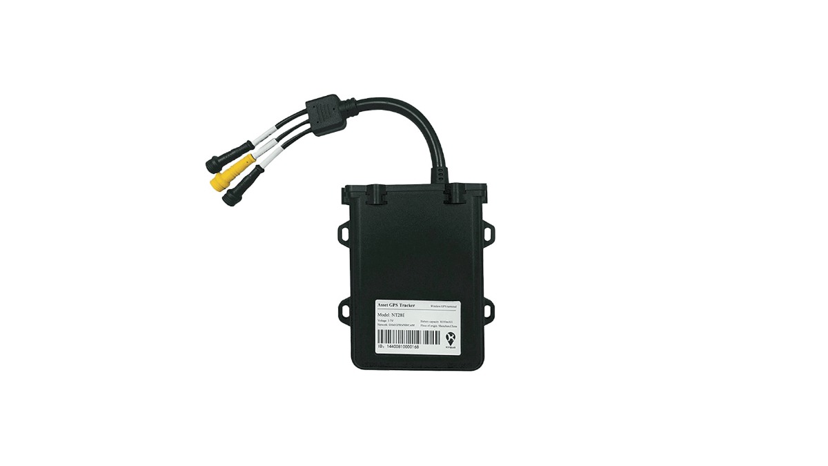
GPX Intelligence is built for complete farm asset visibility, combining real-time GPS and BLE tracking with environmental sensors on a single AI-driven platform. It secures high-value machinery, tracks returnable assets like bins and crates, monitors livestock movement, and protects produce through the cold chain from field to processor. Geofencing, motion alerts, and tamper detection turn the system into an active security layer, while dwell dashboards and efficiency reports surface where time and fuel are being lost.
The GPX AssetTag uses BLE for low-cost, scalable coverage of smaller implements and returnable containers, and its replaceable battery delivers up to four years of life in the field. Combined with GPS units on tractors, trailers, and irrigation equipment, it gives agribusinesses one map for everything they own and move. Native integration with farm management, ERP, and fleet systems means location data drives decisions instead of sitting in a silo. Learn more on the GPX agribusiness solutions page.
Best for: Complete farm visibility, cold chain monitoring, livestock tracking, and asset security across mixed fleets.
2. John Deere Operations Center and JDLink
For farms already running green equipment, John Deere Operations Center paired with JDLink telematics offers deep machine integration. It delivers location, machine health, fuel use, and field activity directly from the equipment, and feeds guidance and documentation tools across the operation. The strength is OEM-level data depth on Deere machinery. The tradeoff is that it is centered on the Deere ecosystem and is less suited to tracking mixed-brand fleets, livestock, or returnable assets.
Best for: Large operations standardized on John Deere equipment that want machine-level telemetry.
3. Trimble Ag (PTx Trimble)
Trimble is a precision agriculture mainstay known for high-accuracy guidance. With RTK (Real-Time Kinematic) correction, its systems reach centimeter-level positioning for autosteering, planting, and variable-rate application. Trimble Ag Software layers field mapping, guidance lines, and agronomic records on top of that hardware. It excels at precision in the field but is a guidance and agronomy platform first, not a dedicated theft-prevention or cold chain solution.
Best for: Precision planting, spraying, and harvesting where centimeter accuracy drives input savings.
4. AGCO Fuse and CLAAS Telematics
These OEM telematics platforms serve farms running AGCO brands (Massey Ferguson, Fendt, Challenger) or CLAAS machinery. Both provide fleet-level visibility into machine location, utilization, and maintenance needs, and both connect to dealer service networks for uptime support. Like other OEM systems, their value is highest within their own brand families and thins out across mixed equipment lines.
Best for: Fleets standardized on AGCO or CLAAS equipment that want telematics tied to dealer service.
5. Tracki 4G
Tracki is one of the smallest and most affordable GPS trackers available, which makes it a popular pick for quick theft prevention on tools, generators, and small implements. It installs in seconds with magnets, Velcro, or clips, supports geofencing and SOS alerts, and works on global cellular coverage. The tradeoffs are subscription dependence, limited industrial durability for harsh field conditions, and no real cold chain or fleet analytics layer.
Best for: Ultra-portable, low-cost theft prevention on smaller high-risk assets.
6. Bushel Farm (formerly FarmLogs)
Bushel Farm is a mobile-first field and operations platform that handles field mapping, activity tracking, weather, and equipment movement. It is strong on the recordkeeping and planning side and is friendly to small and midsize farms that want a simple app rather than a hardware rollout. It leans toward field management and agronomy rather than dedicated asset security or environmental sensing.
Best for: Small to midsize farms wanting mobile field management and basic equipment movement records.
7. Climate FieldView (Bayer)
Climate FieldView is a data platform that connects equipment, collects field data, and powers variable-rate prescriptions to cut input waste. With FieldView Drive, it pulls real-time data wirelessly from machinery and centralizes yield, planting, and application maps. Its core value is agronomic decision-making and input optimization rather than asset tracking or theft prevention, so it pairs well with a dedicated tracking layer rather than replacing one.
Best for: Data-driven input optimization and variable-rate application across field crops.
| Solution | Best For | Tracking Technology | Standout Strength | Ideal Operation |
|---|---|---|---|---|
| GPX Intelligence | Complete farm visibility, cold chain, livestock, asset security | GPS + BLE + sensors | One platform for equipment, assets, livestock, and shipments with theft alerts and AI insights | Mixed fleets of any size |
| John Deere Ops Center / JDLink | Deere equipment telemetry | GPS + machine telematics | Deep OEM machine health data | Large Deere-standardized farms |
| Trimble Ag (PTx Trimble) | Precision guidance and mapping | RTK GPS / GNSS | Centimeter-level accuracy | Precision row-crop operations |
| AGCO Fuse / CLAAS Telematics | Brand-specific fleet telematics | GPS + machine telematics | Dealer-linked uptime support | AGCO or CLAAS fleets |
| Tracki 4G | Portable theft prevention | 4G GPS | Tiny, low-cost, instant install | Small high-risk assets |
| Bushel Farm (FarmLogs) | Mobile field management | App-based GPS | Simple recordkeeping and planning | Small to midsize farms |
| Climate FieldView (Bayer) | Input optimization and VRA | GPS data platform | Variable-rate prescriptions | Data-driven field crops |
A quick word on cost: pricing in agricultural tracking spans a wide range because the categories solve different problems. Portable theft-prevention trackers start around 30 to 40 dollars per device plus a modest subscription. Dedicated precision guidance and autosteer hardware typically runs from about 600 dollars for entry-level systems to more than 5,000 dollars for centimeter-accurate RTK setups, with high-accuracy correction services (such as RTX or similar) adding a few hundred to several thousand dollars per year. Enterprise asset-visibility platforms like GPX Intelligence are subscription-based and scale with the number and type of assets you track, which is why the right comparison is not sticker price but total return per asset protected.
Multi-Layered Tracking: Comparing GNSS, BLE Mesh, RFID, and Satellite Failover for Farms
The strongest agricultural tracking strategy rarely relies on one technology. Each has a job, and the best platforms blend them so coverage never breaks between the field, the shed, and the road.
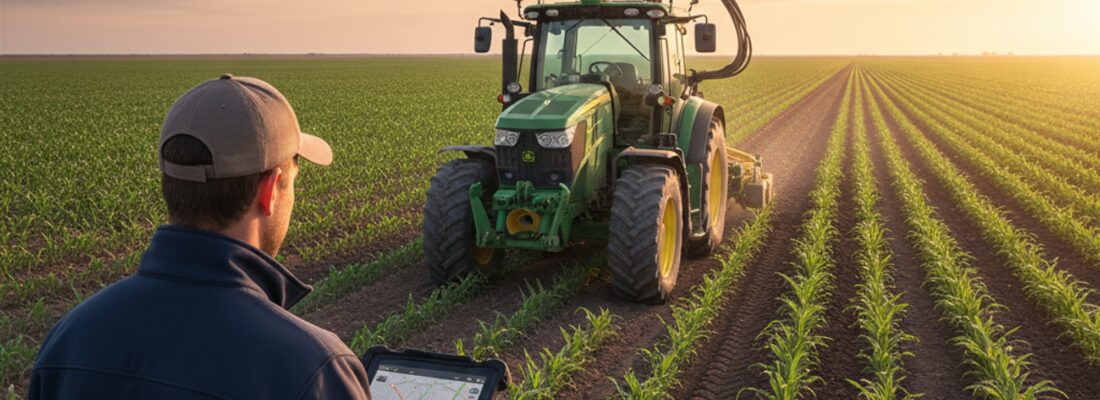
- GPS and GNSS: The backbone for powered, mobile, high-value equipment like tractors, sprayers, trailers, and irrigation units that move across wide areas and need live location anywhere. Standard GPS lands within roughly 20 to 30 centimeters, while multi-constellation GNSS (drawing on GPS, GLONASS, Galileo, and BeiDou) with RTK (Real-Time Kinematic) correction tightens that to centimeter-level accuracy. That precision is what powers autosteering and variable-rate application, cutting overlap, operator fatigue, and input waste on top of basic location.
- BLE (Bluetooth Low Energy): Ideal for high-volume, lower-cost, or unpowered assets such as small implements, returnable bins, crates, and cages. BLE tags are inexpensive, last for years on a battery, and scale to hundreds of items without straining the budget. BLE mesh networking lets nearby tags relay through one another, extending coverage across a yard or shed without a reader at every point.
- RFID: Best for fast scanning at fixed points, such as logging crates through a packing line or checking livestock through a gate. It confirms presence and movement at choke points rather than continuous location.
- Satellite failover: The backup for true rural dead zones where cellular coverage fails, keeping high-value assets visible in the most remote fields and transport corridors. Solar-powered IoT trackers extend that reach further by removing the need to recharge units left in the field for months.
Layering these is what separates a basic tracker from real farm intelligence. GPS tells you where the tractor is, BLE tells you which implements left with it, sensors confirm the produce stayed cold, and geofencing alerts you the moment something crosses a boundary it should not.
Maximizing Farm ROI: How Precision GPS Cuts Input Waste and Prevents Unplanned Downtime
Tracking only matters if it pays. The numbers from precision GPS adoption are hard to argue with: industry studies report net benefits of roughly 3 to 12 dollars per acre, input cost savings of up to 20 percent, and average crop yield increases near 15 percent, while GPS-guided and autonomous machinery can cut field overlap by as much as 90 percent. Across agribusiness deployments, that return shows up in six repeatable ways:
- Theft reduction and recovery: Live location, geofencing, and tamper alerts deter theft and dramatically improve recovery odds when equipment does go missing, protecting assets that often cost six figures each.
- Lower spoilage: Continuous condition monitoring catches temperature excursions before product is lost, turning predictive spoilage alerts into protected yield and protected customer relationships.
- Less idle time and fuel waste: Asset utilization metrics and dwell dashboards expose underused machinery and excessive idling, with modern GPS systems shown to cut fuel and chemical use by up to 15 percent.
- Reduced input waste: Precision guidance and variable-rate field data cut double-planting and over-application, with GPS-guided planting alone shown to reduce seed costs by around 10 percent.
- Less unplanned downtime: Monitoring engine hours and vibration feeds predictive maintenance schedules, so machines get serviced before they fail and stay running through the planting and harvest windows that matter most.
- Faster compliance: Detailed, tamper-resistant location and condition history turns audit and traceability reporting from a scramble into a query.
Stack these gains and the system typically pays for itself well inside its first season, which is why GPS tracking has shifted from a luxury to a baseline expectation for competitive agribusinesses.
Secure Your Farm Assets with GPX Intelligence
Your equipment, livestock, and harvest are too valuable to manage on guesswork. GPX Intelligence unifies GPS, BLE, and sensor tracking on one AI-driven platform so you can prevent theft, protect the cold chain, cut downtime, and prove compliance, all from a single map on your desktop or phone. From seed to market, you get the visibility to run a tighter, safer, more profitable operation. Explore GPX agribusiness tracking solutions and see how real-time visibility turns location data into farm-level ROI.
Frequently Asked Questions (FAQs)
How does RTK GPS differ from standard GNSS tracking in agriculture?
Standard GNSS tracking locates assets within 20 to 30 centimeters, which is fine for basic fleet management and theft prevention. RTK (Real-Time Kinematic) GPS provides sub-inch, centimeter-level accuracy, which is what precision farming tasks like autosteering, variable-rate seeding, and minimizing crop overlap require. Many farms run both: standard GNSS for asset visibility and RTK for in-field guidance.
Can I track a mixed fleet of John Deere, AGCO, and unpowered implements on one screen?
Yes, but not through standard OEM apps, which each show only their own brand. To unify a mixed fleet you need a hardware-agnostic IoT platform like GPX Intelligence that uses API integrations to pull data from OEM telematics, then combines it with aftermarket BLE tags for unpowered implements, routing everything into one dashboard, or single pane of glass.
How does GPS tracking help with FSMA Section 204 compliance?
Under the FDA Food Traceability Rule, packers and farms must provide rapid chain-of-custody data for high-risk foods. IoT sensors paired with GPS trackers log continuous temperature, humidity, and location data, automatically generating the digital audit trails needed to respond quickly when records are requested.